
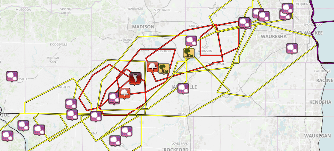
Path of destruction. From live radar and later helicopter and ground survey crews, the National weather Service created this map. Spared were the Madison and Milwaukee population centers.
Farm herds decimated; houses, barns gone
EVANSVILLE, Wis. – Two tornadoes — one rotating at 135 mph, the other at 110 – tore through southern Wisconsin from colliding storm fronts stretching the Illinois border near Janesville almost to Lake Michigan. Touchdowns were less than a minute in any one place. Meteorologists had reports of debris being swept 10,000 to 15,000 feet into the the air. Only minorin juries were reported. A motorist was taken to a hospital after his car was pushed off the road. Rescuers found some people with oxygen tanks whose batteries were running low and the electricity being out. Counties activated warming centers for displaced persons. The storms were rare for February. Never had there been a February tornado in the state since records were begun in 1986. This explanation has been extracted from a National Weather Service summary:
“As a dynamic low tracked northeast across the Upper Mississippi Valley, the warm sector spread into Wisconsin. The afternoon sunshine allowed surface-based instability to develop. Along with the increasing instability, there developed a plethora of deep-layer and low-level shears. This led to of rotating storms with large hail and tornadoes.”
Tornado tracks
Rock County (Janesville, county seat): 24.2 miles, 500-yard swath, 135 mph. Roughly from Evansville to Lake Koshkinong through Rock, Dane and Jefferson counties. 5:12 p.m., then 14 minutes.
Green County (Monroe, county seat): 8.3 miles, 50-yard swath, 110 mph. Crossed River between Juda and Albany. 5:41 p.m, then 36 minutes.

After long drop. A tornado airlifted the grain trailer. Where’s the tractor for what had been an 18-wheel rig? Who knows. Image: Anthony Wahl