
TEN SLEEP, Wyo. — The search for missing Minnesota hiker Grant Gardner on Cloud Peak has focused on his likely route down from the 13,100- foot summit. It was at the summit that he cell-phoned his wife August 29. Gardner said he made it to the top and was exhausted. Nobody has heard from him since. The call was at 7:30 p.m. with, it’s believed, a storm with lightning moving in — a not uncommon afternoon and evening weather situation in the Big Horn mountains. People experienced with the mountains believe Garner probably started down to seek shelter below timberline where he had pitched his pup tent. The tent was found early in the search. It was flattened by hail. Searchers doubt that Gardner made it down the 3,000 feet in elevation to timberline in the dark. Predators like bears and wolves seldom venture above timberline. Smallish black bears roam at lower elevations.
Cloud Peak profile
There are no trails to the Cloud Peak through the denuded boulder fields and treacherous drops, some vertical. Complicating the search is that Cloud Peak is not a Fuji-like cone but only a high point, a kind of bulge, on the 200-mile ridge that’s the spine of the Big Horn mountains that stretch from Montana into north-central Wyoming. The route Gardner chose was the 22-mile Mistymoon Lake Trail from the West Ten Sleep trailhead. The trail has a 5,400-foot elevation gain. The final 3,000 feet are barren bolder fields, mostly devoid of paths. Passage requires by going around and over boulders, often hand over hand. The ascent is rated Level 2 on the five-step Yosemite Decimal Scale. Class 2 means that climbing doesn’t require gear like carabiners, pulleys and helmets but means traversing through terrain like taluses or scree where footing can unstable and requiring hands for balance and reaching out. The Mistymoon Lake route takes 12 to 12-1/2 hours. Gardner had planned three days for his solo adventure. Big Horn outfitters, who offer guide services, advise against solo ascents.
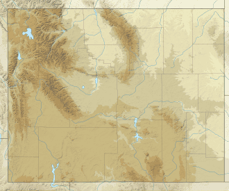
Big Horn range. East of Yellowstone Park in this Wyoming map showing mountain ranges in dark brown. Historically the Big Horns were an impenetrable barrier to pioneers traveling west across the Great Plains.
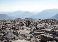
Above timberline. A barren boulder-strewn moonscape, Image: Travel Wyoming
Wicked weather
Turbulence at 39,000 feet in this area on the evening before Gardner vanished caused a Delta airliner to drop 3,000 feet like a rock before the pilot regained control. Injured: 25 people on board.